Netpas Vessel Monitor AIS
"Netpas Vessel Monitor AIS"
-

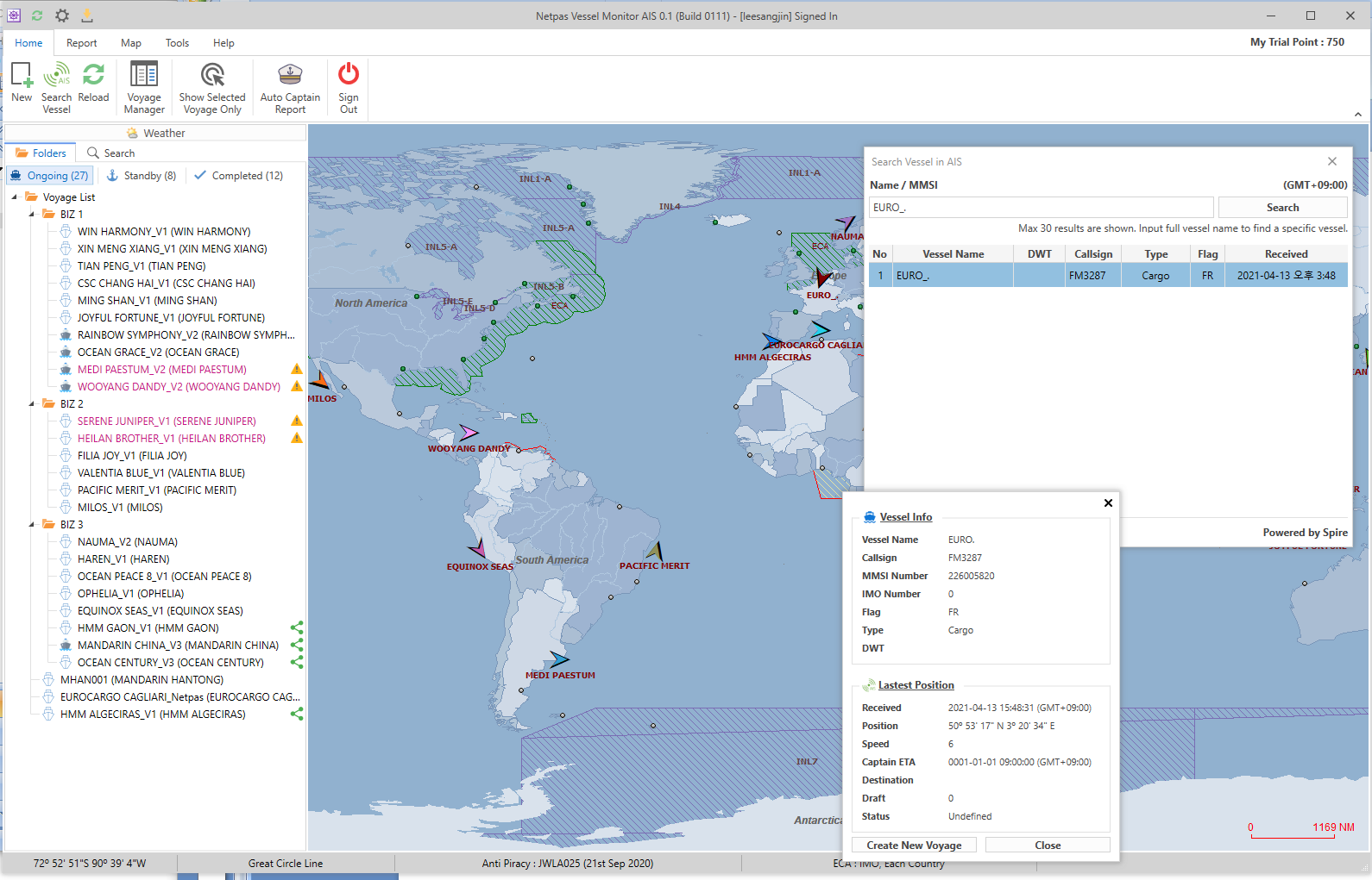
Real-time vessel position using Satellite AIS
-

Routing on the map
-

Share Voyage
-

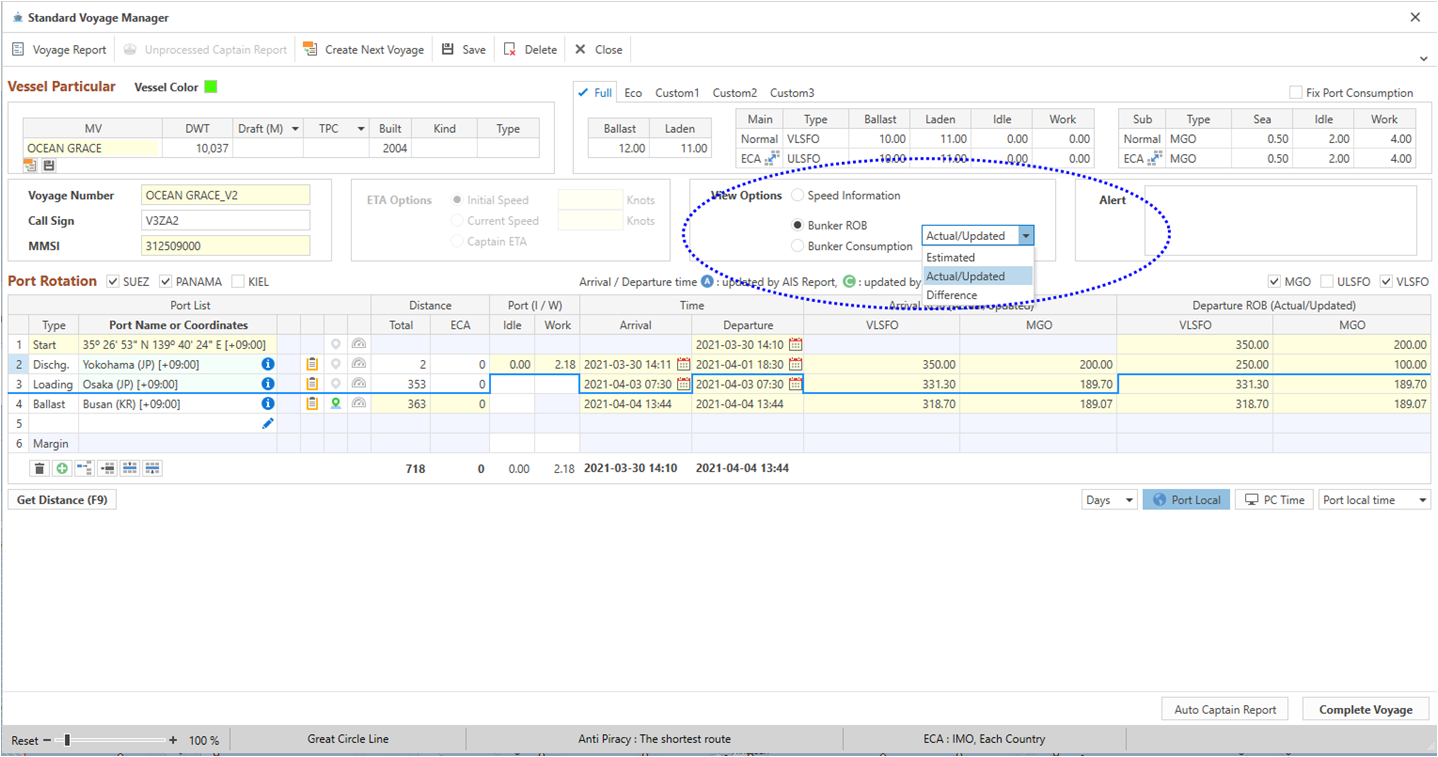
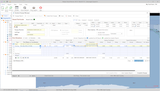
Powerful Report
-

Speed and Bunker Consumption Comparison and Analyze
-

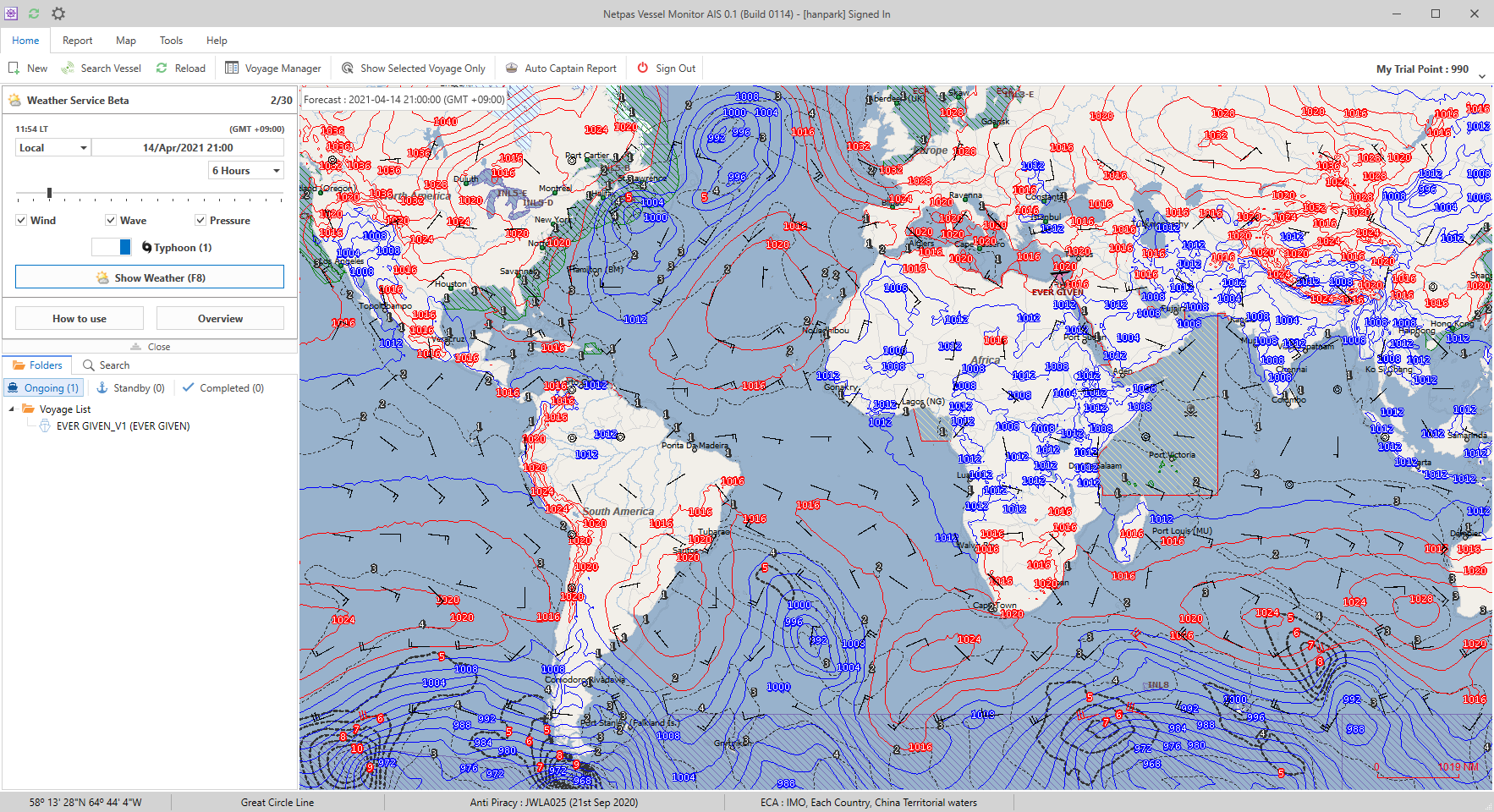
Weather Forecasting
Real-time vessel position using Satellite AIS
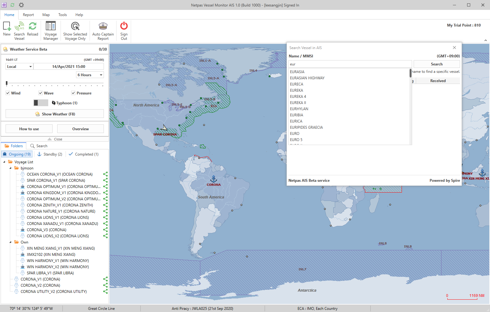
You can search your vessel real-time position using terrestrial and satellite AIS
Routing on the map
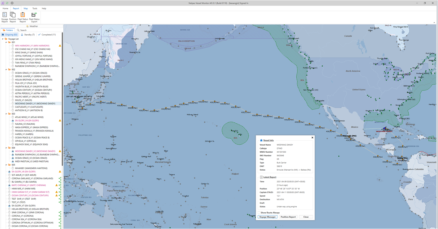
You can check your real time fleet voyage status on the map
Share Voyage
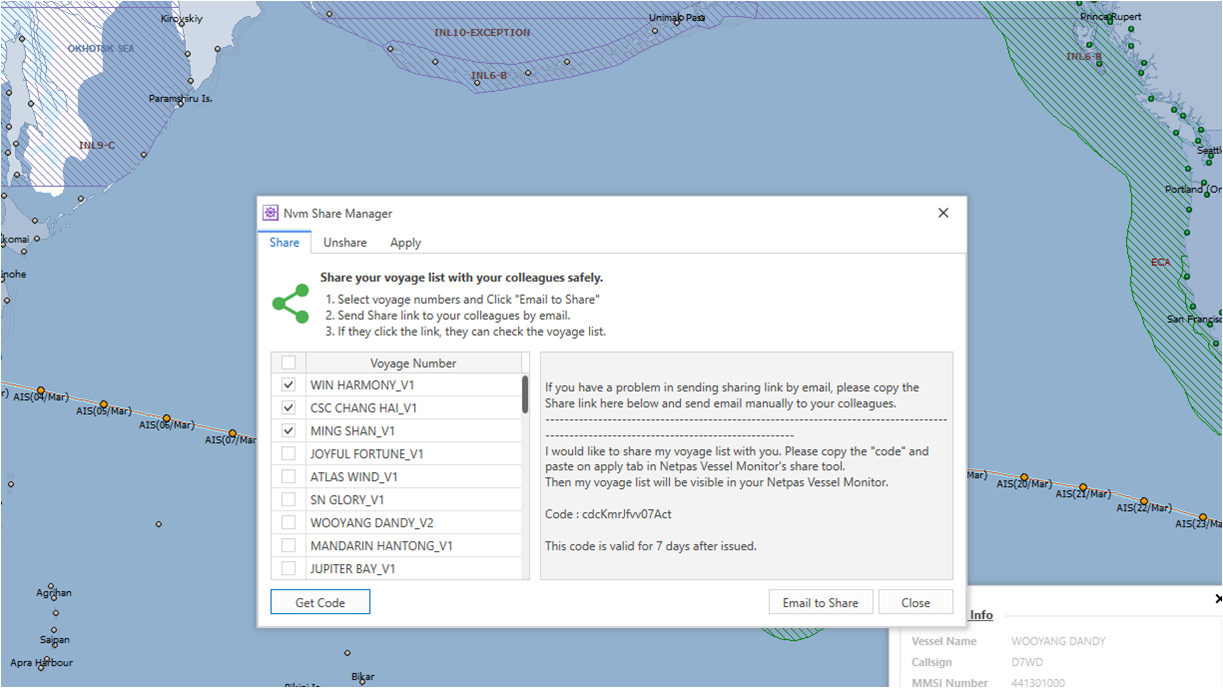
You can share and unshare your monitoring vessels with your colleagues easily.
Powerful Report
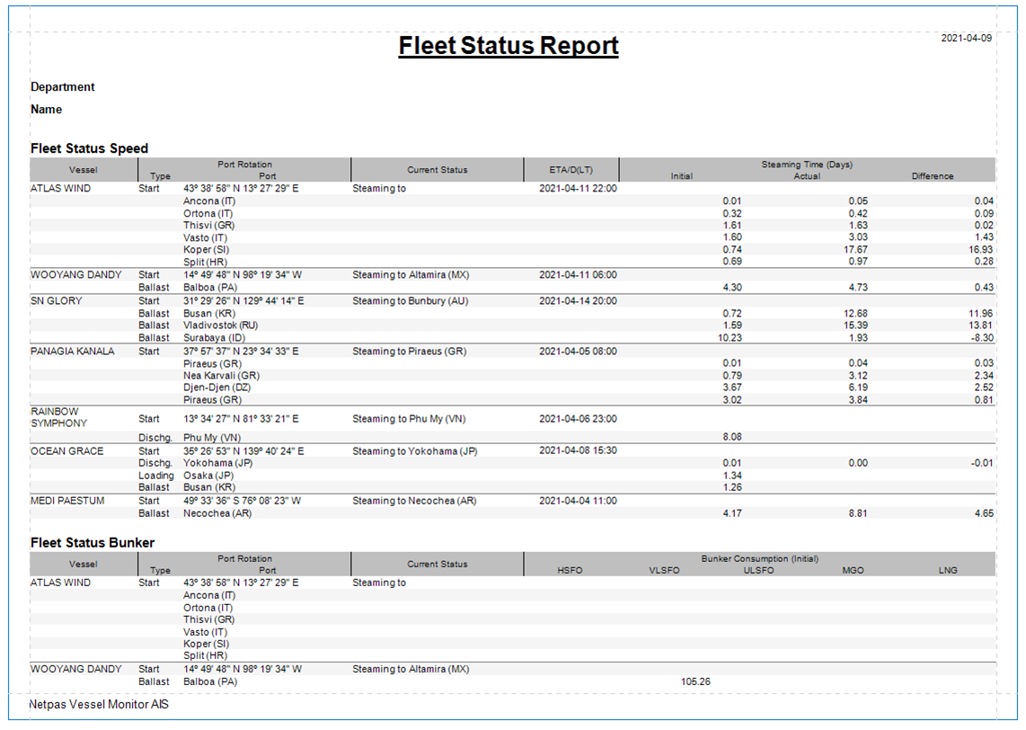
Position reports are received and saved automatically for all of your tracking vessels. Based on the received position reports, it produces Voyage and Fleet Status reports to check the voyage status at glance.
Speed and Bunker Consumption Comparison and Analyze
It provides speed and bunker consumption comparison and analysis between vessel’s initial speed/consumption and actual performance.
Weather Forecasting
It shows weather forecast for your vessel.
Benefits
- - Cost effective tracking solution even including Satellite real-time monitoring.
- - Analyze and build up the record of the voyage and vessel performance.
- - Powerful reporting tools and share your reports easily
Most Cost Effective Fleet Managing Service
Netpas Vessel Monitor (NVM) AIS is fleet manage service using terrestrial and satellite AIS. You can simply find the vessel and monitor the voyage at Netpas map by AIS. All necessary information such as ETA, current position, remaining distance, current ROB and many other fruitful and details are provided and you can share your voyages with your colleagues for entire voyages management. After the close of the voyage, NVM provides easy and useful report function just for you to have successful report to your supervisor.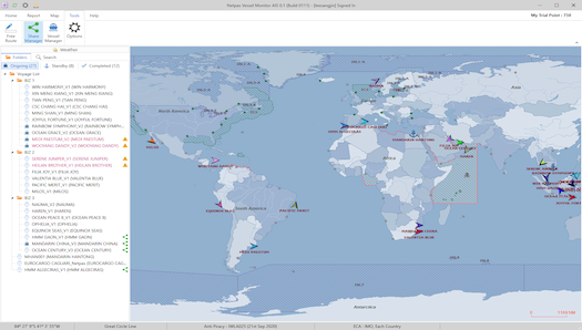
Free Trial
You can try out Netpas Vessel Monitor AIS for 2 weeks as free trial.
You will be given 200 coins at free of charge to start with NVM AIS service during free trial period.
10 coins for 10 days monitoring for 1 vessel needed.
* Free trial terms and conditions can be changed or stopped without any prior notice.
* Free points are valid during trial period only.
Price
10 coins = 10 days monitoring for 1 vessel
10 coins = USD 10
(* Valid Netpas Distance License needed in order to use NVM AIS)
How to get Free Trial?
Step1. Create Netpas ID
Create ID NowStep2. Download & Install
Download Now Free trial user doesn't need license key.
How to use
Main Functions
Real-time vessel position using AIS
You can search your vessel real-time position using terrestrial and satellite AIS
Routing on the map
You can check your real time fleet voyage status on the map
Share Voyage
You can share and unshare your monitoring vessels with your colleagues easily.
Powerful Report
Position reports are received and saved automatically for all of your tracking vessels. Based on the received position reports, it produces Voyage and Fleet Status reports to check the voyage status at glance.
Speed and Bunker Consumption Comparison and Analyze
It provides speed and bunker consumption comparison and analysis between vessel’s initial speed/consumption and actual performance.
Weather Forecasting
It shows weather forecast for your vessel.
Business Registration Number : 105-86-61489
President : ByungJoo Moon
Address : 5th Floor, Dasung Building, 199, Gangdong-daero, Gangdong-gu, Seoul, 05402, Rep. of Korea
Telephone : +82-2-6469-4566 Fax : +82-2-324-9408
E-Mail : sales@netpas.net