Netpas Distance
"Most Popular & Powerful Distance Table Tool being used by 300,000 users from more than 70,000 companies, 130 countries around the world."
-

World's No.1 Distance Table
-

Coordinates to Coordinates /
Coordinates to Port
Distance -

Alternative Routing Point (RP)
-

Anti Piracy Options
-

Weather and Typhoon Service
-

Sea Ice / Ice Line / IWL
-

SECA Distance / Bypass SECA Distance
-

Simple Estimation
-

Vessel Manager
World's No. 1 Distance Table
Netpas provides the world's largest Distance Table with more than 12,000 ports and 60 millions distance data.
Coordinates to Coordinates / Coordinates to port distance
Netpas is one and only to provide Coordinates to Coordinates distance in the world. You can get distance from Coordinates to Coordinates / Coordinates to Port using unlimited database we provide.
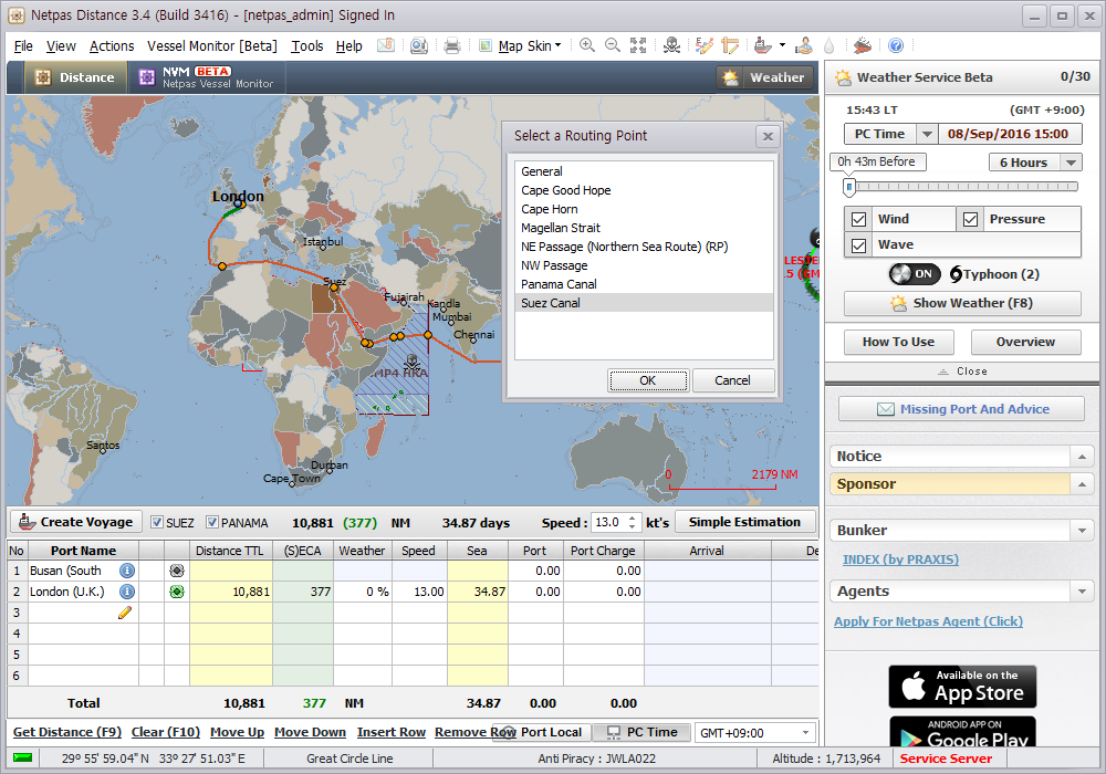
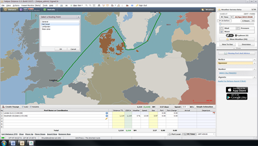
Alternative Routing Point (RP)
You can choose Alternative Routes you want using hundreds of Routing Points we provide.
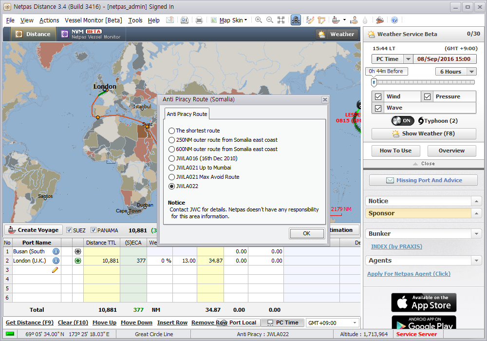
Anti Piracy Options
By given various Anti Piracy Options provided, you can choose a route to avoid piracy zone.
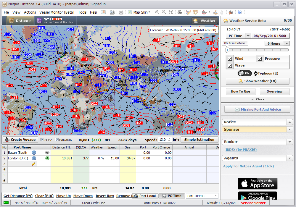
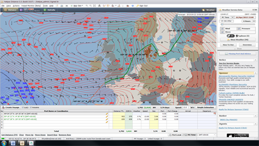
Weather and Typhoon Service
You can check out the current weather and typhoon information including wind, pressure, and wave condition.
Moreover, you can find the weather forecast for your future voyage.
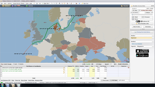
Sea Ice / Ice Line / IWL
Netpas shows Sea Ice, Ice Line, and IWL for your safe voyage.
SECA Distance / Bypass SECA Distance
SECA/ECA distance is shown separately on the voyage for your convenience.
Netpas is one and only to provide Bypass SECA distance in the world You can also check out for Bypass SECA distance.
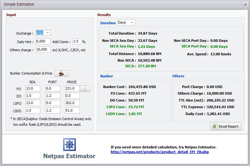
Simple Estimation
Simple and easy to estimate your voyage.
It would give you helpful information on total duration, bunker consumptions, SECA distance and many others.
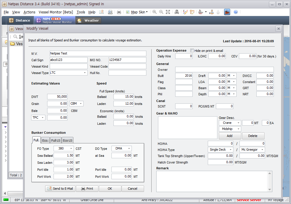
Vessel Manager
You can share with your vessel information with your colleagues to manage fleets.
Benefits
- - Seamless service with providing the largest number of ports. Quick and easy with super user-friendly UI
- - One stop service with various necessary tools, weather, holidays, tide, SECA, piracy, sea ice, Ice berg etc.
- - Reasonable price, just 15.84 USD for 1 month.
Smart solution smart business
Netpas Distance has attracted user worldwide over 130 countries and now became one of mandatory program for daily work in maritime industry. It is basically designed for easy use and user friendly interface with powerful tools.Netpas Distance provides 12,000 ports information with their locations and offers 72 0.1 billion distance database with 150 routing points. Only Netpas Distance provides coordinates to coordinates distance with other fruitful information. Enhance your working environment and get benefit by using Netpas Distance and experience the excellence in maritime business.
Netpas Distance License Policy
How to get Free Trial?
Step1. Create Netpas ID
Create ID NowStep2. Download & Install
Download Now Free trial user doesn't need license key.
How to use
How to calculate "Get Distance"
1. Input more than two ports / country names, and Click "Get Distance".2. You can input up to 20 ports / countries.
How to get "Weather"
1. Click "Show Weather", and It shows weather effects such as wind, pressure, and wave condition.2. You can set the time bar for checking the future forecast around your vessel position.
Main Functions
World's No. 1 Distance Table
Netpas provides the world's largest Distance Table with more than 12,000 ports and 60 millions distance data.
Coordinates to Coordinates / Coordinates to port distance
Netpas is one and only to provide Coordinates to Coordinates distance in the world. You can get distance from Coordinates to Coordinates / Coordinates to Port using unlimited database we provide.
Alternative Routing Point (RP)
You can choose Alternative Routes you want using hundreds of Routing Points we provide.
Anti Piracy Options
By given various Anti Piracy Options provided, you can choose a route to avoid piracy zone.
Weather and Typhoon Service
You can check out the current weather and typhoon information including wind, pressure, and wave condition.
Moreover, you can find the weather forecast for your future voyage.
Sea Ice / Ice Line / IWL
Netpas shows Sea Ice, Ice Line, and IWL for your safe voyage.
SECA Distance / Bypass SECA Distance
SECA/ECA distance is shown separately on the voyage for your convenience.
Netpas is one and only to provide Bypass SECA distance in the world You can also check out for Bypass SECA distance.
Simple Estimation
Simple and easy to estimate your voyage.
It would give you helpful information on total duration, bunker consumptions, SECA distance and many others.
Vessel Manager
You can share with your vessel information with your colleagues to manage fleets.
Business Registration Number : 105-86-61489
President : ByungJoo Moon
Address : 5th Floor, Dasung Building, 199, Gangdong-daero, Gangdong-gu, Seoul, 05402, Rep. of Korea
Telephone : +82-2-6469-4566 Fax : +82-2-324-9408
E-Mail : sales@netpas.net